
9 AM to 7 PM Monday-Saturday
+91-9251896140 (Sales)
+91-9251896143 (Technical)
+91-9166273732(HR)
Geo-spatial Technology |GIS|DGPS|inSAR | LIDAR | RADAR Data|Satellite Image|Data Provider|Companies In Delhi NCR | India
Geo-Spatial Data for Various Application
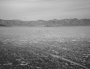
Geo Spatial Coordinates for Telecom Network.
Telecom Network GIS can be a great planning and GIS analysis decision making tool for telecom industries. GDi GISDATA enables wireless telecommunication organizations to incorporate geographic data in to the complex network design. The planning, optimization, maintenance and activities are the main. This technology allows telecom to enhance a variety of application.These application are like engineering application, customer relationship management and location based.
-
Topographical and Cadastral mapping.
-
Utility Mapping.
-
Route Network Analysis.
-
Digitization/Vectorization.
-
Water Resources Planning.
-
GCP Data Capture and analysis.
-
Image GeoRectification Georeferencing.
-
Rural/Urban:Planning,Development & Management

Satellite Image| Provider Company.LIDAR|RADAR|InSAR.
We are the satellite image data provider in Delhi, India. This Can be used the Various Project Like Disaster Managements, information Geology & Mineral Resources.
-
Geo spatial Data for Disaster managements.
-
Geo spatial Infrastructure map.
-
Mineral oil Exploration Mine Areas.
-
Geo morphology map.
-
Ground water table map.
-
Geo spatial for Geological Map.

Geospatial Info for Water Resource Managements
An orthophoto, or orthomosaic is a large image of an area which can be used to measure actual distances between any
two given points on the image. A normal photograph by Lidar Drone Survey | 3D Lidar Mapping | 3D Laser Scanning as taken from above is not uniform in terms of scale. It means that the ratio of the distance between two points on a photo to the actual distance between the same two points on the
ground. However, an orthomosaic is such that the scale of the image to the actual ground is uniform, thus representing the Earth’s actual surface.

Geo spatial Info for Land Managements| Delhi NCR
The Customers can receive field-based information Geology & Mineral Resources.
-
Land use/Land cover map.
-
Infrastructure map.
-
Mineral oil Exploration Mine Areas.
-
Drainage map.
-
Geo morphology map.
-
Ground water table map.
-
Geological Map.
Geo Spatial Coordinates for Mineral Resource Mapping
Digital surface model is a digital representation of the Earth’s surface (in terms of height). In other words, DSM provides the height of all the points on Earth as seen from above such as buildings, trees etc. It can be obtained directly from any standard Lidar Drone Survey | 3D Lidar Mapping | 3D Laser Scanning software. Aerial Mapping produced the data for Digital Surface Model.

Geospatial Data For Agriculture Sector | Crop Estimation
The Customers can receive field-based information including crop identification, crop area determination and crop condition monitoring (health and viability). Satellite data are employed in precision agriculture to manage and monitor farming practices at different levels.
Crop type classification.
Crop condition assessment (crop
monitoring, damage assessment).
Crop yield estimation Weather resistant.

SAR | InSAR Geospatial Data For Change Detection
We are expertise in delivering the the best quality of services in subsidence monitoring and change detection for dump yard stability, mine subsidence monitoring, dam Stability, using different remote sensing data. ,InSAR (5-15 mm),DInSAR (5-15 mm), PSInSAR (5-15mm), GBInSAR (5-15 mm)
-
Land slide harzard Zonation
-
Land use/Land cover map
-
Dump yard stability,
-
Mine subsidence monitoring,
-
Dam Stability

Our Services Location are |Delhi Mumbai | Kolkata | Bangalore India
Our Company is the best in Remote Sensing | GIS services company | GIS Mapping | Image Processing | Satellite Image Data provider companies in Delhi NCR, India.
Geospatial Technology is AN rising field of study that has Geographic system (GIS), Remote Sensing (RS) and world Positioning System (GPS). Geospatial technology allows United States of America to amass information. That's documented to the world and use it for analysis, modeling, simulations and mental image.
-
Satellite Data imagery Provider.
-
LIdar Data Services.
-
Administrative Shape File.
-
GIS Analysis Services.
-
Modeling and Simulations.
-
3D visualization Services.
-
RADAR Data Provider.
-
Satellite image data provider in Delhi NCR, India.
-
GIS Analysis Services company in Delhi.
OUR SERVICES
Domain Technology
-
GIS & Remote Sensing
-
3D Laser Scanning
-
UAV Aerial Drone Survey
-
GPS & DGPS Technology
-
LIDAR Technology
-
Total Station
-
Digital Level
-
GIS Analysis Tools
Sector
-
Construction & Infra
-
Architecture & Design
-
Agriculture Sector
-
Telecom Network
-
Transmission Line
-
Mineral and Resource
-
Mine and Energy sector
-
Road Construction
